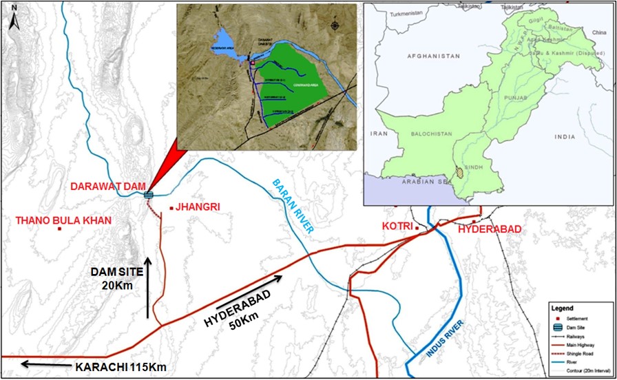
Background : Sindh, one of the four provinces of Pakistan, is primarily an agrarian region heavily dependent on its irrigation systems for agricultural productivity. However, the Kohistan area of Sindh presents a unique challenge due to its saline and deep groundwater, which poses a significant threat to the sustainability of the agricultural sector in the region. In response to this challenge, the Sindh government recognizes the urgent need to establish a specialized entity dedicated to managing water resources effectively and sustainably in the Kohistan area along with operation and maintenance of newly constructed Drawat Dam.
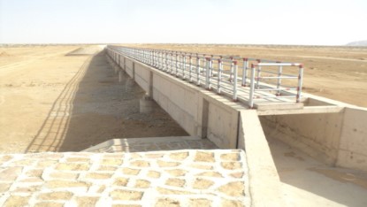
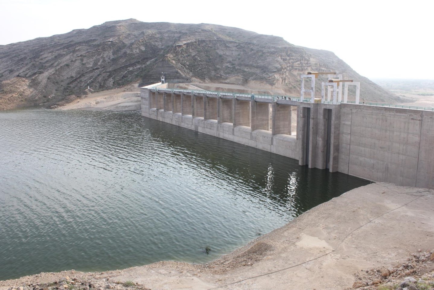
Concept : In the view of the current situation of Kohistan arid zone The Sindh Governemnt and Sindh Irrigation Department constructed Drawat Dam a reservoir for the rain water to store and utilize it for irrigation and agriculture purpose for the area. The Sindh Government already constructed Drawat Dam and off taking canals to provide water to locals for domestic and Agriculture purposes.
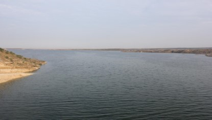
This dam will serve as a critical infrastructure component for water storage and management in the region, mitigating the impacts of saline groundwater and ensuring a reliable water supply for agricultural, Domestic and industrial activities.
Addressing salinity issues is crucial for sustaining agricultural productivity in Kohistan. Comprehensive salinity management strategies will be developed and implemented. These include measures such as groundwater recharge projects, saline water exclusion schemes, and soil improvement initiatives. These measures aim to combat the adverse effects of salinity on crop yields.
Actively engage with local communities, farmers, and other stakeholders to ensure their participation and support in water resource management initiatives. Collaboration with relevant governmental agencies, academic institutions, and non-governmental organizations will also be prioritized to leverage expertise and resources for achieving the authority's objectives.
Environmental sustainability will be a core consideration in all activities undertaken by the authority. Measures will be implemented to minimize the ecological impact of dam construction and operation, preserve biodiversity, and promote the adoption of environmentally friendly agricultural practices among farmers in the region.

|
|
||
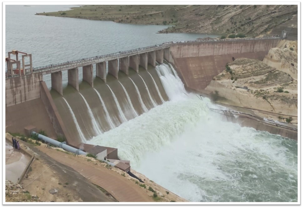
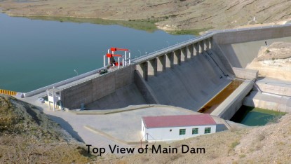
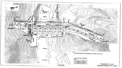
| I. | Total Length | 306m (1004 ft) |
| II. | Height of Dam | 46m (151ft) |
| III. | Gross Storage Capacity | 150 MCM (1,21,790 AF) |
| IV. | Live Storage Capacity | 110 MCM (89339 AF) |
| V. | Dead Storage Capacity | 40 MCM (32451AF) |
| VI. | Pond Level (Design) | 195.5 |
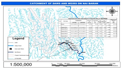
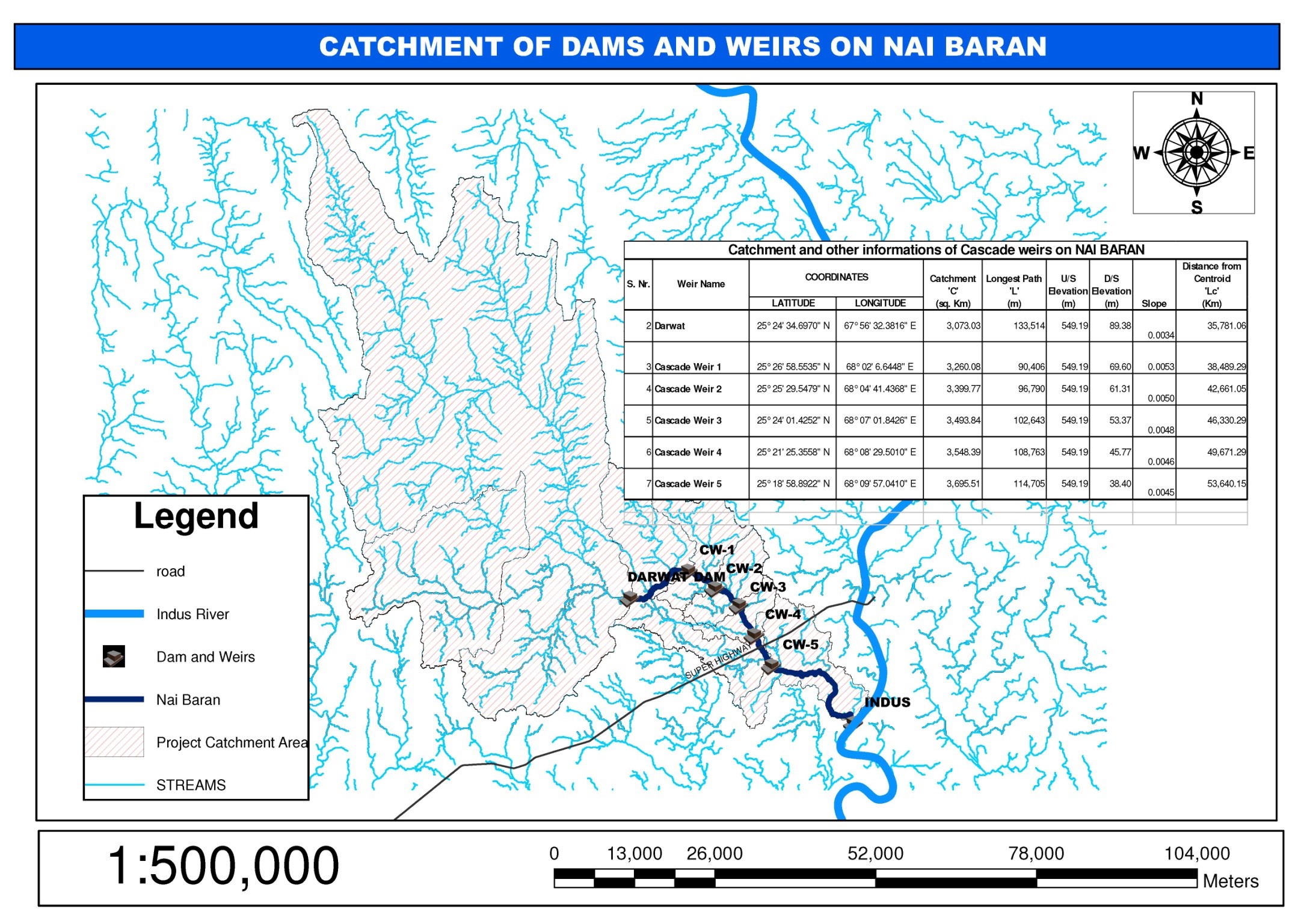
| VII. | Catchment area | 3073 sq-km |
| VIII. | Reservoir area | 28.38 sq-km |
| IX. | Highest Flood Level | 119.86m (393 ft) |
| X. | Normal Storage Level | 112.55m (369 ft) |
| XI. | Dead Storage Level | 106.00 m (348 ft) |
| XII. | Width of bay | 60 feet |
| XIII. | Number of Divide walls | 2 |
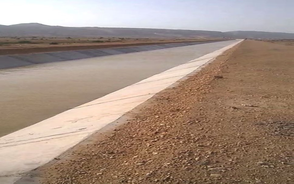
| XIV. | Total Length of Canals | 6473 miles |
| XV. | Total Length of Water Courses | 47800 miles |
| XVI. | Longest Canal (Nara) | 226 miles |
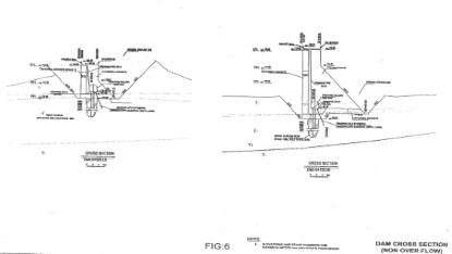
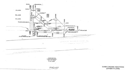
(OVERFLOW SECTION)
|
|
||
| I. | Type | Ungated Ogee |
| II. | Capacity | 3600 cumecs (127152 cusecs) |
|
||
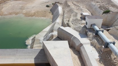
Irrigation |
||
| III. | Sill Level | 104 m (341 ft) |
| IV. | Diameter | 1.4 m (4.59 ft) |
| V. | Max flow | 4.42 cumecs (156 cusecs) |
| VI. | Supply Pipe Length | 869.45 meter |
Scour |
||
| VII. | Sill Level | 98.5 m (323 ft) |
| VIII. | Diameter | 2 m (6.56 ft) |
| IX. | Max flow | 6.54 cumecs (231 cusecs) |
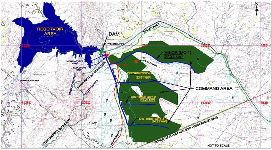
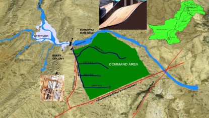
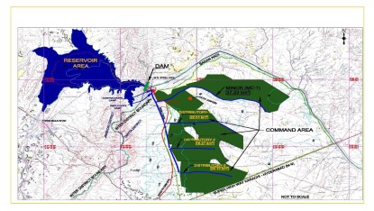
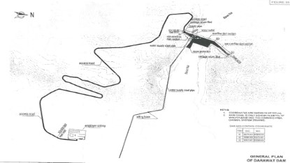
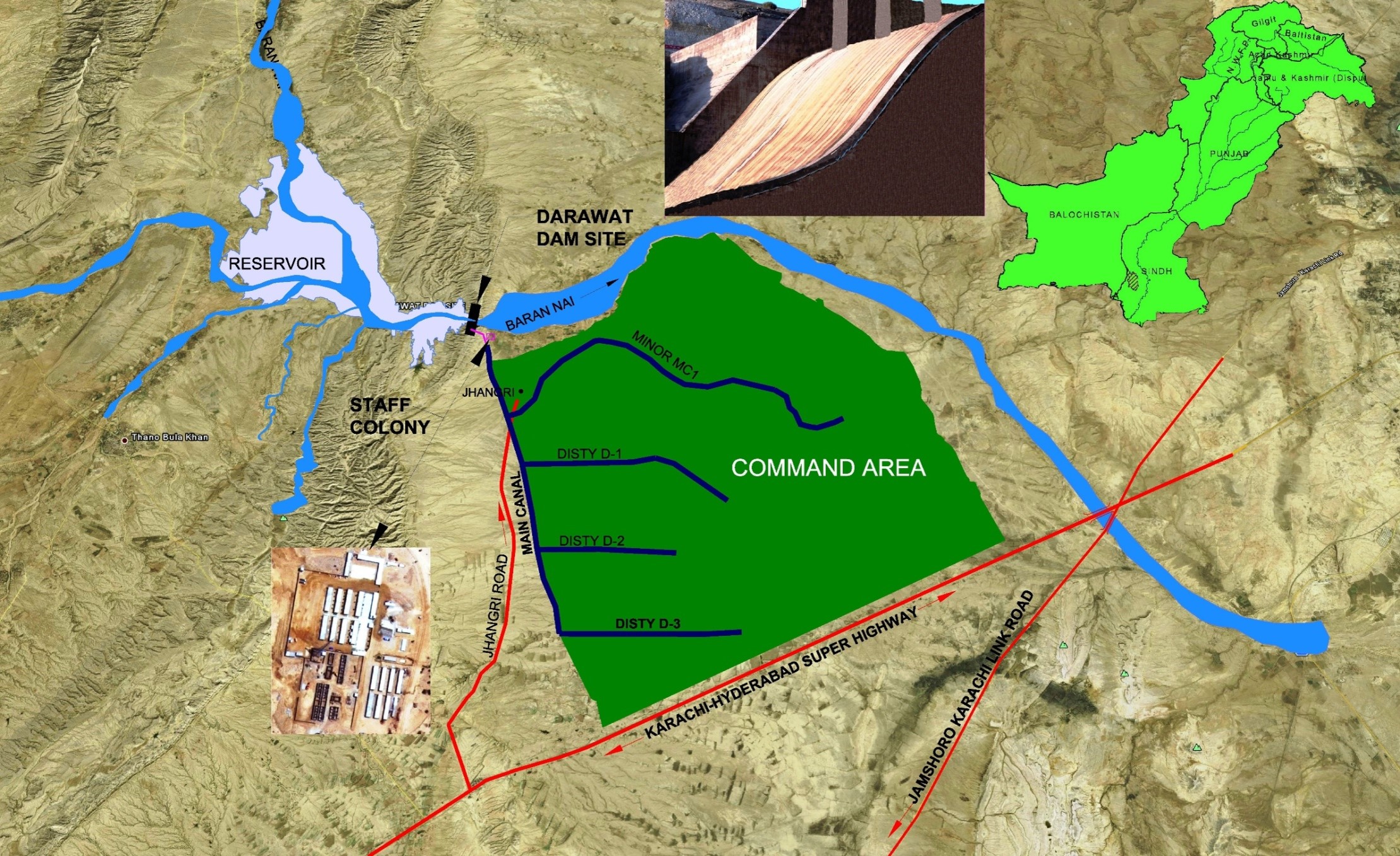
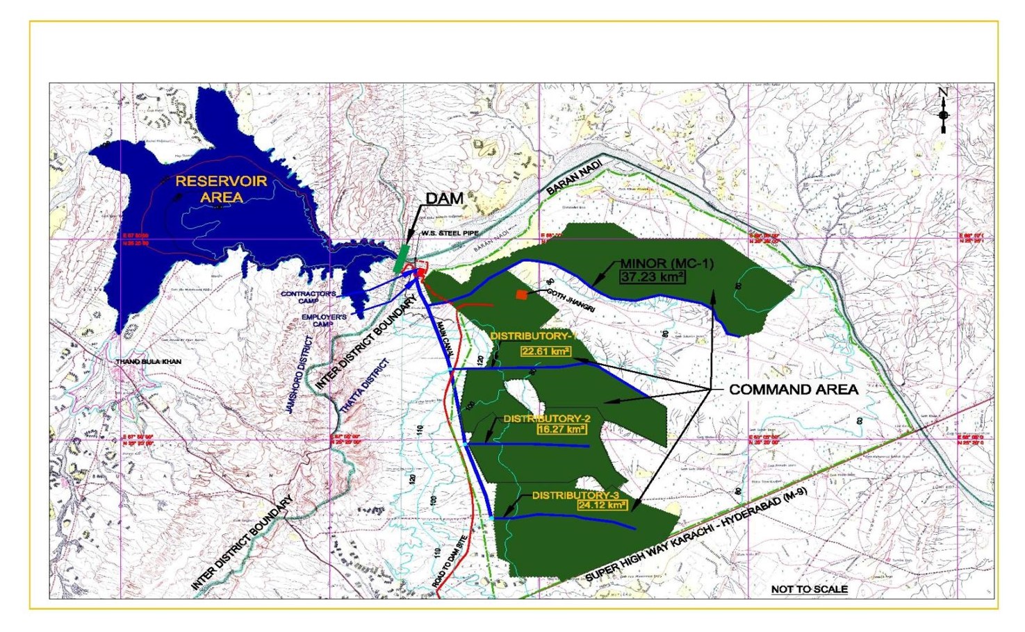
Darawat Dam
| Name of Canal | Length | Outlets
(Nos.) |
Design Discharge | Area to be Cultivated(CCA) | ||
| Km | Right | Left | Total | Cusecs | Acres | |
| Main Canal | 11.929 | - | - | - | 156 | 25000 |
| MC-1 | 14.60 | 20 | 4 | 24 | 58 | 9251 |
| D-1 | 8.52 | 12 | 5 | 17 | 35.2 | 5652 |
| D-2 | 5.0 | 7 | 8 | 15 | 25.3 | 4067 |
| D-3 | 5.9 | 8 | 9 | 17 | 37.6 | 6030 |
| Total | 45.949 | 47 | 26 | 73 | 156 | 25,000 |
PC-I was initiated on the directives of Honorable President of Pakistan .
Original PC-1 Amounting to Rs. 3,175.00 Million Was Approved by ECNEC on September 3, 2009.
1st Revised PC-1 Amounting to Rs. 9,300.00 Million Was Approved by ECNEC on August 16, 2012.
2nd Revised PC-1 Amounting to Rs.11,767.87 Million with FEC Rs.1980.05 Million Approved by ECNEC on 22.05.2018.
The Darawat Dam was completed on 2014.
WAPDA handed over Irrigation System to Sindh Irrigation Department on 27.10.2018
WAPDA handed over Main Darawat Dam on 4.12.2020. However, for staffing, SNE is lying in Finance Department for Approval since long.


