Flood Managment


The Sindh Irrigation Department has recently initiated a dedicated region focused on implementing advanced flood management techniques and strategic interventions. This crucial endeavor aims to mitigate risks and minimize the potential damage caused by monsoon-induced flooding in the rivers and canals within the Sindh province.
Additionally, the department aims to promptly alert the respective chief engineers, enabling them to swiftly implement remedial measures, thus curbing the adverse impact of heavy rainfall and soaring river gauges.
The Department has created initially following posts :
The flood have caused massive damage to infrastructure and Crops in Sindh Province, besides loss of life. Monetary losses during the major floods aggregate billion dollars.
Major floods during the year 1973, 1976, 1988, 1992, 2010 , 2011 , 2018 , 2020 ( LBOD ) and 2022 resulted in inundation of millions acres of land in various parts of Sindh which constituted one of the most serious environmental hazards Floods are detrimental not only in financial terms, but also in their ability to severely undermine the productive system, which needs to be free from uncertainties and frequent disruptions.
Thus the Flood management in Sindh Irrigation Department Headquarter at Hyderabad performs the following tasks in the best public interest.

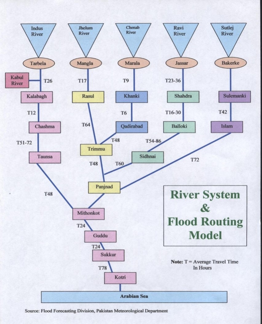
Sindh is the lower riparian of Indus Basin Irrigation System. The discharge of all the western and eastern rivers of Pakistan viz. Indus, Kabul, Jhelum, Chenab, Ravi and Sutlej accumulated at Mithan Kot and then entered in Sindh Province at Gudu Barrage. Thus Sindh Province is most vulnerable to river floods as accumulated flow from entire Indus Basin is to be conveyed to sea through the province.
Type of Floods in Sindh : There are three main causes of floods in Sindh
River Flood
Hill torrents Flood
Rain/cyclonic Flood
