Background : The Guddu Barrage stands as the pioneering structure in Sindh, nestled close to Kashmore City, marking its significance since its commissioning in 1962. Crafted under the meticulous design of Mr. M. L. Champhekar in 1945-46, it materialized after a rigorous review by Sir T.W. Foy in 1953, culminating in final approval three years later.
With a remarkable layout boasting 64 bays of 60' each and a navigational lock gate spanning 50', the Barrage assumed a critical role in taming the Indus River's flow. Its strategic positioning and design were aimed at regulating water flow, becoming a vital source supplying irrigation water to a vast expanse—2.9 million acres of agricultural land across Districts Kashmore, Jacobabad, Shikarpur, and Sukkur in Sindh, alongside Nasirabad District in Balochistan Province.
The Barrage's foundations were laid on February 2, 1957, with the construction spearheaded by WAPDA. The grand unveiling and official commissioning took place in May 1962, marking a watershed moment in the region's irrigation and water control infrastructure. A year later, the inauguration ceremony, graced by Field Marshal President Muhammad Ayoub Khan on March 1, 1963, signified its significance in Pakistan's engineering prowess and agricultural development.
The realization of this monumental structure came at a capital cost of 1226.20 million rupees, a testament to the scale and importance attached to ensuring water management and agricultural prosperity in the region. The Barrage, primarily executed by Pakistani engineers, remains an enduring symbol of engineering excellence and serves as a lifeline to the agricultural heartlands it nurtures.
|
|
||||||||||
| I. | DESIGN DISCHARGE. | 12 LAC CUSECS | ||||||||
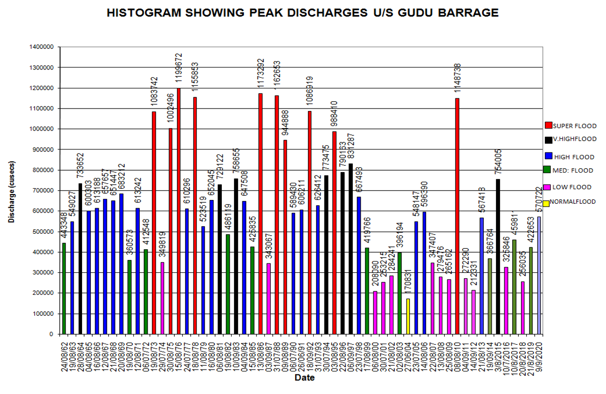
| II. | MAXIMUM DISCHARGE PASSED (1976) | 11,99,672 CUSECS | ||||||||
| DISCHARGE PASSED (2010) DATED 8.8.2010. | 11,48,350 CUSECS | |||||||||
| III. | TOTAL SPANS. | 65 NOS GATES EACH OF 60’ FT SPAN | ||||||||
| IV. | TOTAL LENGTH OF BARRAGE. | 4445 FEET DESIGN | ||||||||
| V. | OFF TAKING CANALS. | |||||||||
| Right Side |
|
|||||||||
| Left Side |
|
|||||||||
| VI. | G.C.A | 2.439 MILLION ACRES | ||||||||
| VII. | C.C.A | 2.234 MILLION ACRES | ||||||||
| VIII. | DESIGN WITHDRAWALS. | 42401 CUSECS | ||||||||
| IX. | CREST LEVEL (WEIR). | 236.00 | ||||||||
| X. | DESIGN POND LEVEL | 255.5 | ||||||||
| XI. | MAXIMUM POND LEVEL. | 259.60 | ||||||||
| XII. | DESIGN CUT OFF. | 20.5’ FT | ||||||||
| XIII. | MAXIMUM GAUGE. | 261.00 | ||||||||
| XIV. | CREST LEVEL OF CANALS. | 244.00 | ||||||||
| XV. | RIGHT POCKET DIVIDE WALL. | 7 No Gates. | ||||||||
| XVI. | LEFT POCKET DIVIDE WALL. | 4 No Gates. | ||||||||
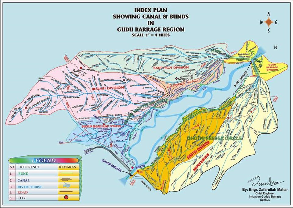
Guddu Barrage Region
Guddu Barrage Region
| Desert Pat Feeder | Begari Sindh Feeder | Total | |
Irrigation Channels Details |
|||
| Main Canal | 3 | 4 | 7 |
| Branch | 3 | 6 | 9 |
| Minor /Distry | 41 | 91 | 132 |
| Total | 47 | 101 | 148 |
Detail of CANALS. |
|||
| Length of Main Canal (M) | 105.34 | 191.2 | 296.54 |
| Length of System (M) | 343.37 | 793.18 | 1136.55 |
| Design Discharge | 13275 | 21000 | 34275 |
| G.C.A M-Acres | 0.392 | 0.981 | 1.374 |
| C.C.A M-Acres | 0.389 | 0.935 | 1.325 |
| Inten-sity | 75% | 75% | |
| No. of Outlets | 1658 | 4228 | 5886 |
NOTE:- |
|||
| 1. Ghotki Canal off takes from Gudu Barrage but it comes under SIDA administration. | |||
|
2. Rainee Canal has been newly constructed by WAPDA. Its design discharge is 10000 cusecs. It is flood canal and will utilize only flood water when water level U/S Gudu Barrage will exceed 2.5 lac cusecs.
|
|||
Guddu Barrage Region
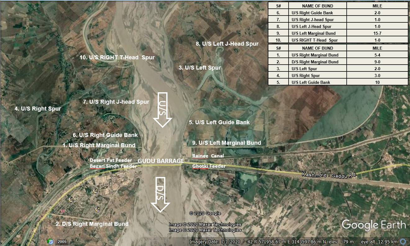
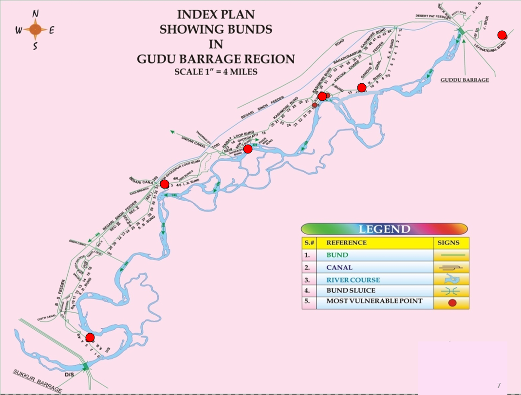
Details of Bunds |
|||
| Bunds | First Line Bund | Second Line Bund | Total Miles |
| District Kashmore | 81-5 | 44-3 | 126-0 |
| District Shikarpur | 31-1 | 26-3 | 57-4 |
| District Sukkur | 8-0 | 3-1 | 11-1 |
| District Rahimyar Khan | 10-3 | - | 10-3 |
| Total Miles | 131-1 | 73-7 | 205-0 |
The Barrage is situated 10 miles north-west of Kashmore and about 100 miles upstream of Sukkur Barrage on River Indus, almost at the northern boundary of Sindh Province. The Barrage has been designed for providing assured water supply and improvement and extension of Irrigation facilities of Sindh and Baluchistan areas, which were being irrigated by inundation canals, the supplies of which were depending on uncertain fluctuating water levels of River Indus. The construction of head works was completed in the year 1962. The whole area commanded by the Guddu Barrage designed non-perennial.
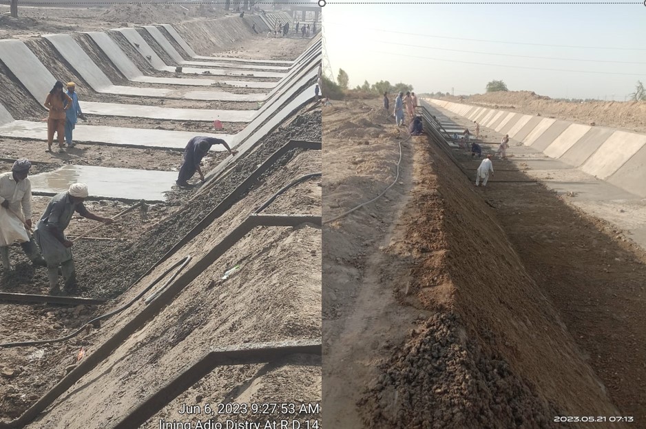
Of the four feeders off-taking from this Barrages, two feeders on the right bank namely the discharge canal and Begari Sindh Feeder provide water for rice cultivation and the third feeder, namely Pat Canal on the right bank and Ghotki on the left bank are designed for dry crop cultivation. The pace of growth in agriculture on this Barrage has been satisfactory and in fact almost all the feeders in Sindh are working for beyond their designed capacity in order to satisfy the growing needs of the farmers. The project was planned to be completed in all respects earlier but due to financial constraints, some works costing Rs.238.8 million are still to be completed
| S# | Date | Guddu Barrage + Balochistan share included | Off taking Channels Position | ||||||||||||
|---|---|---|---|---|---|---|---|---|---|---|---|---|---|---|---|
| U/S Q | D/S Q | Actual W.D | As per 1991 Accord 10 daily W.D |
%
(-) Shortage/ (+) Increase |
Begari SF | Desert Pat Feeder + Balochistan share included | Ghotki | ||||||||
| Actual Q |
As per 1991 Accord
10 daily W.D |
%
(-) Shortage/ (+) Increase |
Actual Q |
As per 1991 Accord
10 daily W.D |
%
(-) Shortage/ (+) Increase |
Actual Q |
As per 1991 Accord
10 daily W.D |
%
(-) Shortage/ (+) Increase |
|||||||
| S.No | Name of Off-taking Canal / Channel | No. of Water Courses | Designed Discharge | Actual Discharge |
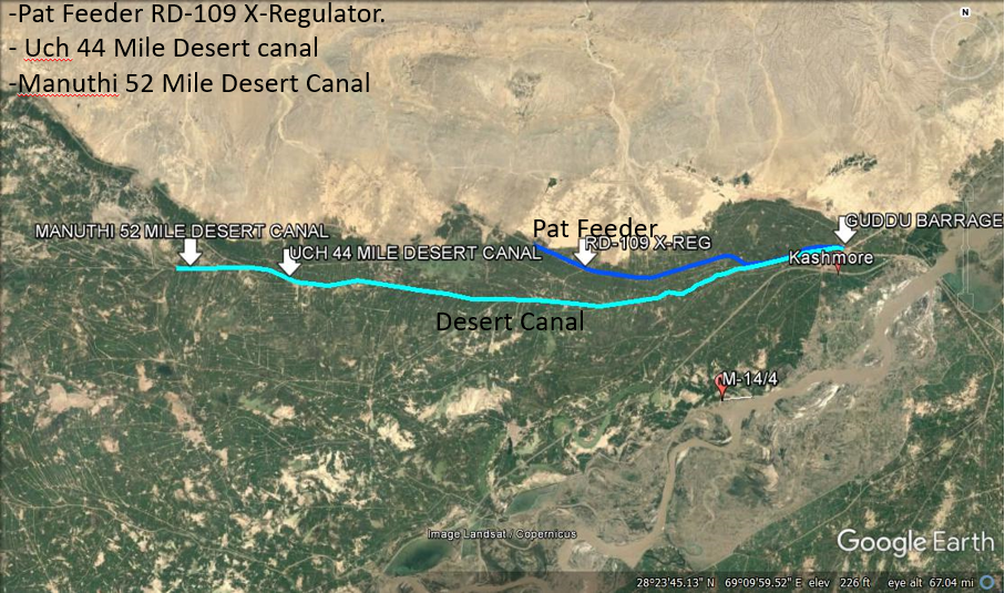
| 1. | Pat Feeder RD-109 | - | 6,700 Cs | 6,700 Cs |
| 2. | Uch Canal. | - | 700 Cs | 700 Cs |
| 3. | Manuthi Canal | - | 600 Cs | 700 Cs |
| 4. | Frontier Canal | 20 No. Water Courses | 71.31 Cs | 172 Cs |
| 5. | Desert Canal | 29 No. Water Courses | 334 Cs | 645 Cs |
| 6. | Noor Wah | 25L (Sharbat Wah) | 50 Cs | 50 Cs |
| 27L (Jamali Wah) | 128 Cs | 128 Cs | ||
| 57AL | 20 Cs | 20 Cs | ||
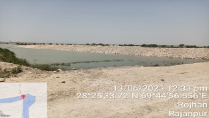
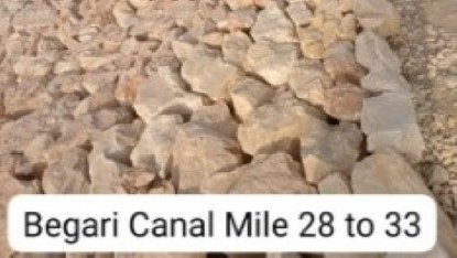
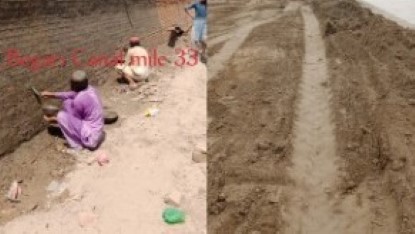
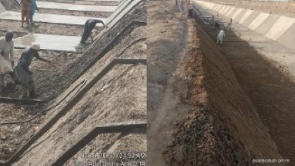
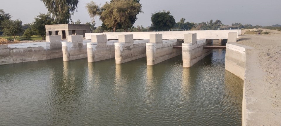
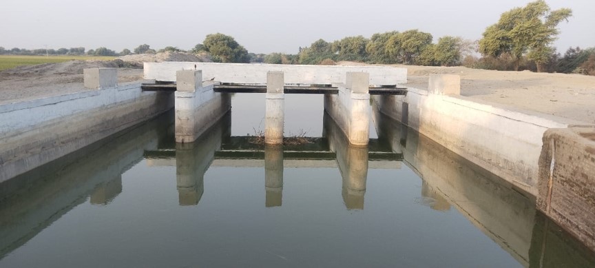
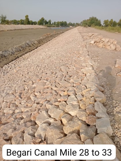
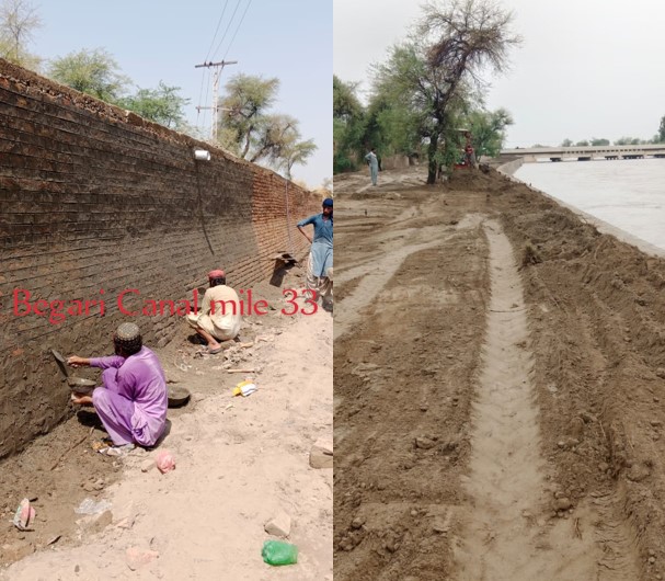
| 7. | Begari Canal | 99 R | 18.42 Cs | 18.42 Cs |
| 8. | Seer Wah | 4L | 5.82 Cs | 5.82 Cs |
| Total | 8,627.55 Cs | 9,139.24 Cs | ||
| S# | Date | Guddu Barrage - Balochistan Share | Guddu Barrage - Desert Pat Feeder Off taking Channels Position | Sukkur Barrage - Balochistan Share via Khirthar RD 102 |
Taunsa Off taking Channel Position
Kachi |
Total Balochistan | |||||||
|---|---|---|---|---|---|---|---|---|---|---|---|---|---|
| Actual W.D |
As per 1991
Accord 10 daily W.D |
%
(-) Shortage/ (+) Increase |
Pat RD 109 | UchDistry | Manhiti | Total Guddu Barrage | Actual W.D |
As per 1991
Accord 10 daily W.D |
%
(-) Shortage/ (+) Increase |
Kachi | |||